Randonnée V.T.T. La Couronne - Nexeya Eaux claires Voeuil Mouthiers - Photo

Nexeya Eaux claires Voeuil Mouthiers

 ludol
ludol

Utilisateur

© OpenStreetMap contributors
Longueur
Longueur
33 km
Altitude max
Altitude max
151 m
Dénivelé positif
Dénivelé positif
578 m
Km-Effort
Km-Effort  
41 km
Altitude min
Altitude min
52 m
Dénivelé négatif
Dénivelé négatif
578 m
Boucle
Boucle
Oui
Date de création :
2016-08-17 00:00:00.0
Dernière modification :
2016-08-17 00:00:00.0

(0 Avis)

V.T.T.
V.T.T.
2h58
Difficulté : Moyen

Scannez ce code QR pour ouvrir la randonnée dans l'application SityTrail

Application GPS de randonnée GRATUITE

Logo SityTrail SityTrail

IGN / Instituts géographiques

Télécharger SityTrail sur l'App Store Télécharger SityTrail sur Google Play

Logo SityTrail SityTrail World

Le monde est à vous

Télécharger SityTrail sur l'App Store Télécharger SityTrail sur Google Play Télécharger SityTrail sur Huawei AppGallery

À propos

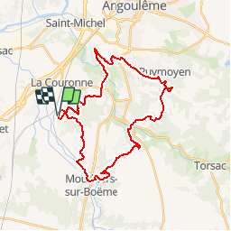
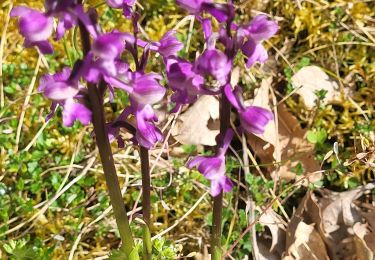
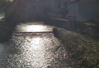
Randonnée V.T.T. de 33 km à découvrir à Nouvelle-Aquitaine, Charente, La Couronne. Cette randonnée est proposée par ludol.

Description

Bonne sortie sportive entre potes

Profil altimétrique

Localisation

Pays :
France
Région :
Nouvelle-Aquitaine
Département/Province :
Charente
Commune :
La Couronne
Localité :
Unknown
Départ:(Dec)
Départ:(UTM)
273722 ; 5052667 (31T) N.

Randonnées à proximité

Randonnée Marche La Couronne - La balade de L'Oisellerie à La couronne  - Photo
Marche
alainjoseph6

Marche

Très facile
La Couronne, Nouvelle-Aquitaine, Charente, France
7 km | 8 km-effort
2h 15min
Oui
Randonnée Marche Mouthiers-sur-Boëme - terra - Photo
Marche
thierry16

Marche

Moyen
Mouthiers-sur-Boëme, Nouvelle-Aquitaine, Charente, France
6,5 km | 7,6 km-effort
2h 42min
Oui
Randonnée Marche Mouthiers-sur-Boëme - terra - Photo
Marche
thierry16

Marche

Moyen
Mouthiers-sur-Boëme, Nouvelle-Aquitaine, Charente, France
6,5 km | 7,6 km-effort
2h 42min
Oui
Randonnée Marche Mouthiers-sur-Boëme - terra aventura - Photo
Marche
thierry16

Marche

Très facile
Mouthiers-sur-Boëme, Nouvelle-Aquitaine, Charente, France
6,5 km | 7,6 km-effort
2h 42min
Oui
Randonnée Marche La Couronne - la couronne405 - Photo
Marche
dededavid

Marche

Moyen
La Couronne, Nouvelle-Aquitaine, Charente, France
5,7 km | 6,9 km-effort
2h 51min
Oui
Randonnée Marche Mouthiers-sur-Boëme - moutiers1 - Photo
Marche
thierry16

Marche

Très facile
Mouthiers-sur-Boëme, Nouvelle-Aquitaine, Charente, France
5,6 km | 6,8 km-effort
1h 35min
Oui
Randonnée V.T.T. Claix - Claix avril 2018 - Photo
V.T.T.
Sergio1664

V.T.T.

Moyen
Claix, Nouvelle-Aquitaine, Charente, France
38 km | 46 km-effort
3h 36min
Oui
Randonnée Vélo Saint-Michel - vrai tour Angoulême  - Photo
Vélo
sguer135

Vélo

Moyen
Saint-Michel, Nouvelle-Aquitaine, Charente, France
35 km | 41 km-effort
2h 21min
Oui
Randonnée Marche Vœuil-et-Giget - vœuil  - Photo
Marche
dorcier

Marche

Facile
Vœuil-et-Giget, Nouvelle-Aquitaine, Charente, France
10,5 km | 12,5 km-effort
2h 45min
Oui


Fermer
Mes abonnements